2 Hursley to Shawford Down
Stage 2 Hursley to Shawford Down
3 miles
Starting Point: The Stone Seat on the A3090, Hursley
Grid reference: 428248
Bus Route: 66
This stage takes the walker through Hursley village, across farmland and out onto Shawford Down.
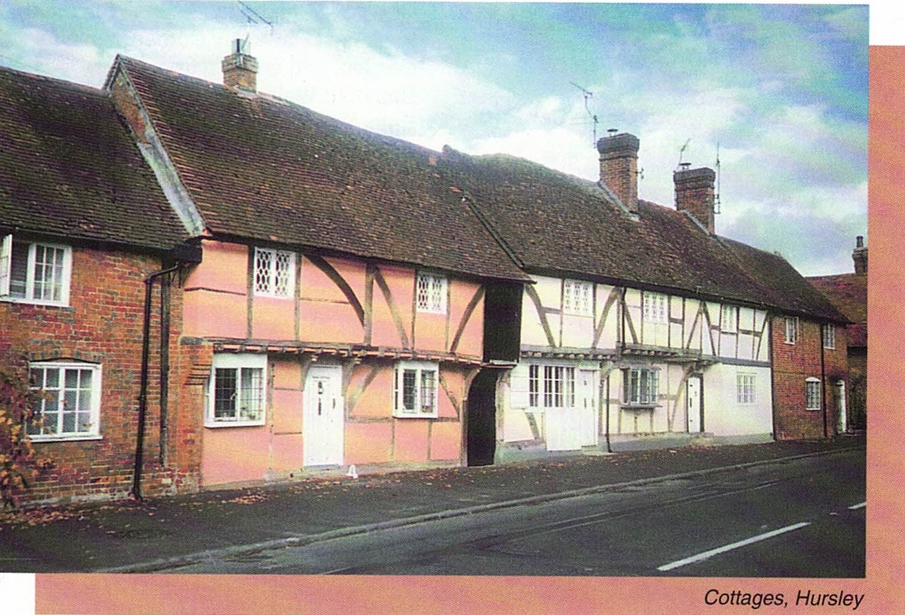
From the stone seat at the entrance to Hursley Park turn left and proceed along the main A3090 Romsey to Winchester road into Hursley, passing by the Dolphin public house. opposite is Pelican Court. Stay on this side of the road and admire a delightful terrace of jettied half-timbered houses with which Richard Cromwell would have been familiar.

Pass the Old Smithy on the opposite side of the street under and evergreen oak, and the village Post Office. Rounding a bend you come upon the parish church, All Saints, Hursley on your left.
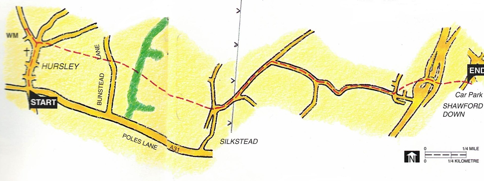
Go past the church and the Parish Hall. The field on your left is the village recreation ground and half-way along it on the roadside is Hursley's almost unique War Memorial. At this point cross over the road, exercising great care as the traffic hereabouts is busy and travels at speed. Turn right once safely across, back in the direction whence you came. After passing the King's Head and just before you reach the butcher's shop turn left up Collins Lane.
100 yards up Collins Lane, before the traffic derestriction signs, take the gravel path uphill on the right. In about 100 yards on the left you will pass the entrance to Hursley Cemetery.
Go along the path, over the stile and into a field, a path runs straight along the edge of the field and continues alongside the wooden pole power lines. Now in the open country there are fine views on your right (to the south) of Ladwell and Cranbury Park. To the left (north) the imposing Shawlands House can be seen.
On approaching Parsonage Farm, follow the path to the right of the small belt of trees and through a gate and through the farmhouse's laurel hedge and wooden fence. Cross the lane, Bunstead Lane, and slightly to the right follow the footpath signpost and over a stile into a field.
Follow the path along the edge of the field keeping the hedge on your right, enjoying beautiful countryside. Leave the field by another stile into a copse of mostly ash and oak. Take a well-defined path through the copse which leads you to another stile into an open field. Ahead now may be seen the chimney stack of Otterbourne incinerator. Follow the path alongside the hedgerow for some distance until, after a slight rise, Silkstead Farmhouse comes into view. Continue straight ahead.
On reaching a lane, Silkstead Lane, at the end of this field, cross a stile, go through a made gap in the hedge down the bank to the lane. Turn left ( north) for 50 yards then turn right (east) onto a bridleway. Follow this broad track and at the fork in 100 yards take the left hand track, with Otterbourne chimney on your right. Go under power lines with fields on your left and woodland on your right. Keep straight ahead at the electricity pylon, ignoring the footpath sign and into the wood.
In approximately 500 yards at a junction of tracks, take the right fork and proceed straight ahead with fields to your right and a copse to your left. Follow this track, which is Shepherd's Lane, through grain and combined harvester stores as it bends through New Barn Farm and descends through scrubland.
The appearance of a wall with rose bushes on your left heralds the return of civilisation and you walk past several pleasant houses. Follow this track until it goes sharp left and meets a tarmac road. Turn right and proceed straight ahead past many large modern homes and uniform leylandii, laurel and beech hedges.
At the crossing of Field Way with Shepherd's Lane, turn left (north) up Field Way for about 150 yards to a sports field. Walk around the field to the gateway diagonally opposite (at the north-east corner to the right of the house). Go through the gate and down the steps onto the road.
Cross the bridge over the M3 motorway and then Winchester Road into the car park alongside the road. Go through the leftmost kissing gate into a wood following a signpost. Proceed ahead through the wood. After about 100 yards the path leads you out onto Shawford Down on a well-defined path. Keep straight ahead, eventually passing an impressive war memorial on the open down as you descend to the carpark below.
